Use this free tool to view your 3D PTX (Point Cloud) files online without needing to install any software. Our PTX viewer tool will generate a real-time 3D preview of your PTX file with Pan and Zoom controls, allowing you to see your 3D model from any angle.
Our PTX viewing tool can load most PTX files, and we are working on improvements all the time to improve compatibility with all file formats. If you are looking to convert your 2D image files to 3D files, such as STL, then we have a 2D to 3D conversion tool here.
| Extension | PTX |
| Full Name | Point Cloud |
| Type | 3D Model/Point Cloud |
| Mime Type | text/plain |
| Format | Text |
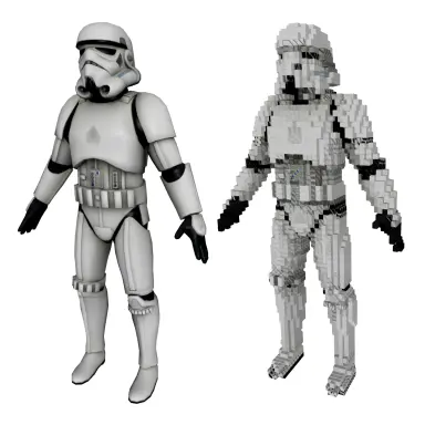
| Tools | PTX Converters, 3D Model Voxelizer, Create PTX Animation, PTX Viewer |
| Open With | MeshLab |
The PTX is a 3D file format used for representing 3D Point Clouds. The format contains only positional information (X, Y, and Z coordinates) for the individual points. The format is often used for digital elevation modeling of terrain for later processing in 3D modeling applications.
As the format only contains positional information, a common task is to convert this into a fully surfaced 3D model using methods such as Alpha Shapes or Delaunay Triangulation. The format can also be viewed without further processing in its raw format.
First, click the "Upload..." button and select the PTX file you wish to view. Once your PTX file has been received it will be displayed in your browser.
We aim to process all PTX file viewing requests as quickly as possible, this usually takes around 5 seconds but can be more for larger or more complex files so please be patient.
We aim to create the most accurate rendition of your PTX file with our tools. Our tools are under constant development with new features and improvements being added every week.
Yes, of course! We do not store the PTX file you submit. The generated preview file within your browser is deleted after 1 hour.
Yes! Our PTX file viewer will run on any system with a modern web browser. No specialist software is needed to use our file viewing tools.
© 2026 ImageToStl. Convert your PNG and JPG Files to 3D STL files.